
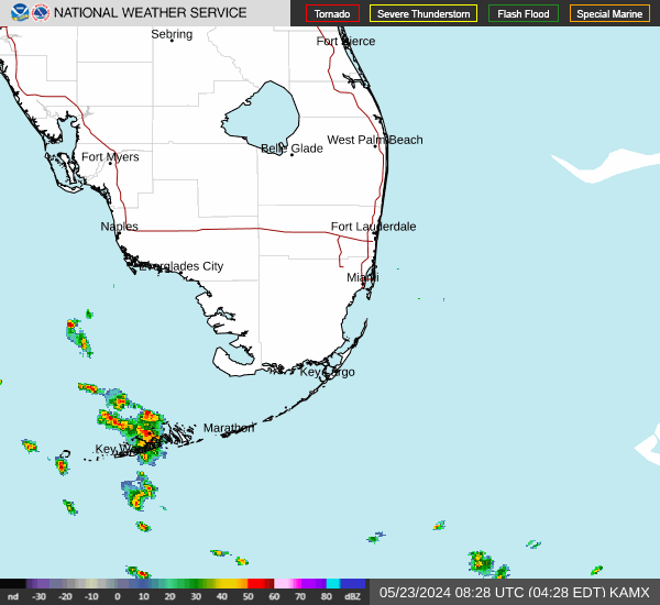
Live from the National Weather Service. The forecast graphs, hazards map and radar image on this page load directly from weather.gov each time you open it. For park closures, check the NPS Alerts & Conditions page; for tropical weather, see the National Hurricane Center.
Watches, warnings and advisories by area
Shark Valley
Homestead entrance and Royal Palm
Flamingo
Gulf Coast (Everglades City)
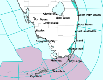
Next 48 hours, by park area
Each graph shows the NWS hourly forecast for that spot: temperature and heat index, rain and thunder chances, wind and humidity. Select a graph to open the full NWS forecast.
Shark Valley
Homestead entrance and Royal Palm
Flamingo
Gulf Coast (Everglades City)
Radar
Everglades weather by season
NPS describes two seasons in South Florida: “warm, humid, rainy summers and mild, dry, pleasant winters.” The summer wet season runs from about mid-May to November, with temperatures into the low 90s °F and frequent thunderstorms; most of the year’s nearly 60 inches of rain falls then. NPS also asks visitors to consider the heat index: at 90 °F with very high humidity, it feels like about 105 °F. Our month-by-month guide covers what each season means for a visit.
Summer thunderstorms bring lightning, and open trails and water offer little shelter. Read the NWS lightning safety and NWS heat safety advice before a warm-season visit.
Before you go: Everglades trail status · choose an entrance · NPS weather page